Burnt Mound – A circular or irregularly shaped mound of material consisting of burnt stones, ash and charcoal with no surface evidence of a trough or depression. Levelled examples can appear as a spread containing burnt stones. These can be of any date from the Bronze Age (c. 2400-500 BC) to the early medieval period (5th – 12th century AD).
Castle Motte – An artificial, steep-sided, earthen mound on or in which is set the principal tower of a castle. Constructed by the Anglo-Normans in the late 12th and early 13th century AD.
Enclosure – An area defined by an enclosing element (e.g. bank, wall, fosse, scarp), or indicated as such cartographically, and occurring in a variety of shapes and sizes, possessing no diagnostic features which would allow classification within another monument category. These may date to any period from prehistory onwards.
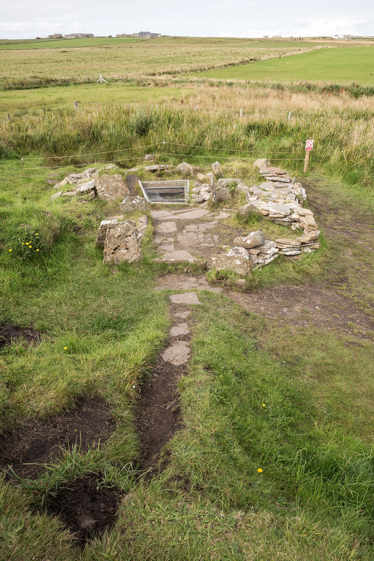
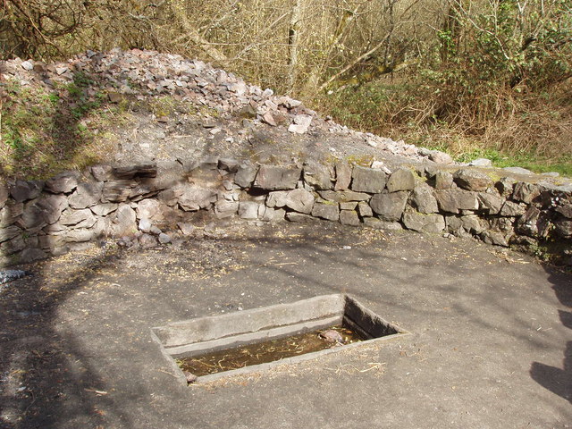
Fulacht Fia – A horseshoe-shaped or kidney-shaped mound consisting of fire-cracked stone and charcoal-enriched soil built up around a sunken trough located near or adjacent to a water supply, such as a stream or spring, or in wet marshy areas. The first recorded use of the Irish term ‘fulacht fiadh/fia’ (cooking pit of the deer or of the wild) as relating to ancient cooking sites was in the 17th century. These are generally interpreted to have been associated with cooking and date primarily to the Bronze Age (c. 2400-500 BC).
Habitation Site – A concentration of archaeological features which are indicative of habitation, the remains being insufficient to allow a more specific classification. These may be of any date up to the medieval period (5th-16th centuries AD).
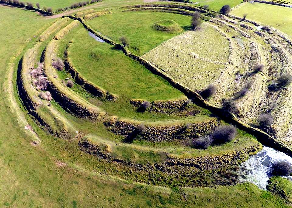
Moated Site – A square, rectangular or occasionally circular area, sometimes raised above the ground, enclosed by a wide, often water-filled, fosse, with or without an outer bank and with a wide causewayed entrance. They date to the late 13th/early 14th centuries and were primarily fortified residences/farmsteads of Anglo-Norman settlers though they were also built by Gaelic lords.
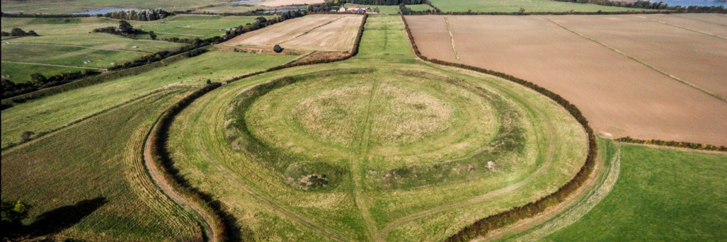
Ringfort – Rath – A roughly circular or oval area surrounded by an earthen bank with an external fosse. Some examples have two (bivallate) or three (trivallate) banks and fosses, but these are less common and have been equated with higher status sites belonging to upper grades of society. They functioned as residences and/or farmsteads and broadly date from 500 to 1000 AD.
Ring Ditch – A circular or near circular fosse, usually less than 20m in diameter and visible as cropmarks/soilmarks on aerial photographs. The function of these monuments is unknown as ring-ditches may be the remains of ploughed out barrows, round houses or other modern features and, in consequence, may date to any period from prehistory onwards.
Ritual Site (Holy Well/Saint’s Stone) – A stone which is associated with a particular saint, and may be considered to have certain miraculous properties. These may have their origins in prehistory but are associated with devotions from the medieval period (5th-16th centuries AD) onwards.