These maps are historically important in that they were the first set of maps produced by a national survey of a country. The survey was conducted by Sir William Petty and its purpose was to measure all land in the country which was to be forfeited by Catholics to ‘Adventurers’ and English soldiers. It was based on the Civil survey records but was much more accurate in its findings using a standardised measuring device, a chain, and a map scale.
Maps below are best viewed in full screen and using the ‘Zoom-in’ feature. The Down Survey maps displayed are as follows:
Page 1 – North Wexford Area
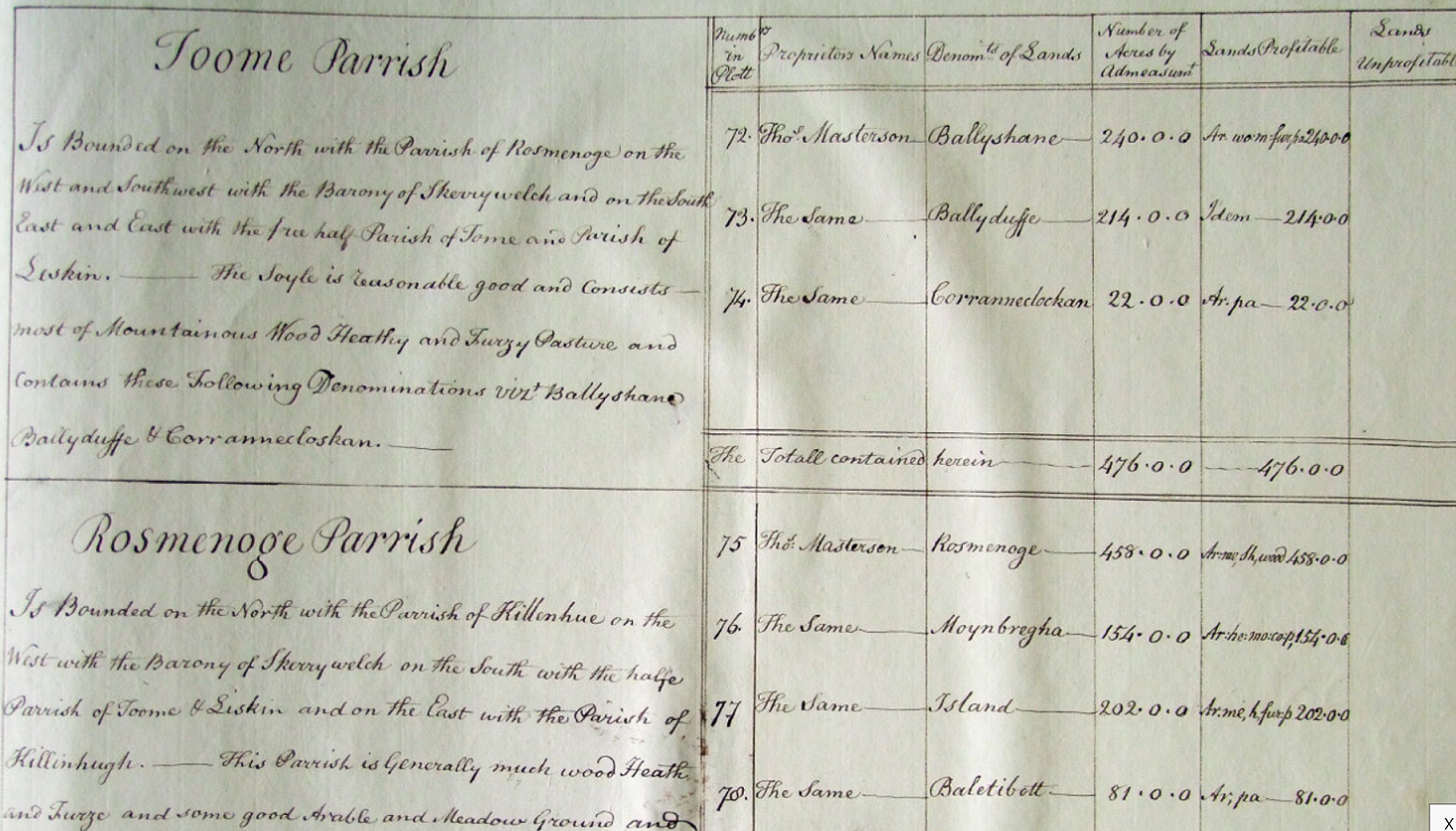
Page 2 – Barony of Gorey – Parishes of Toome and Rosmenoge
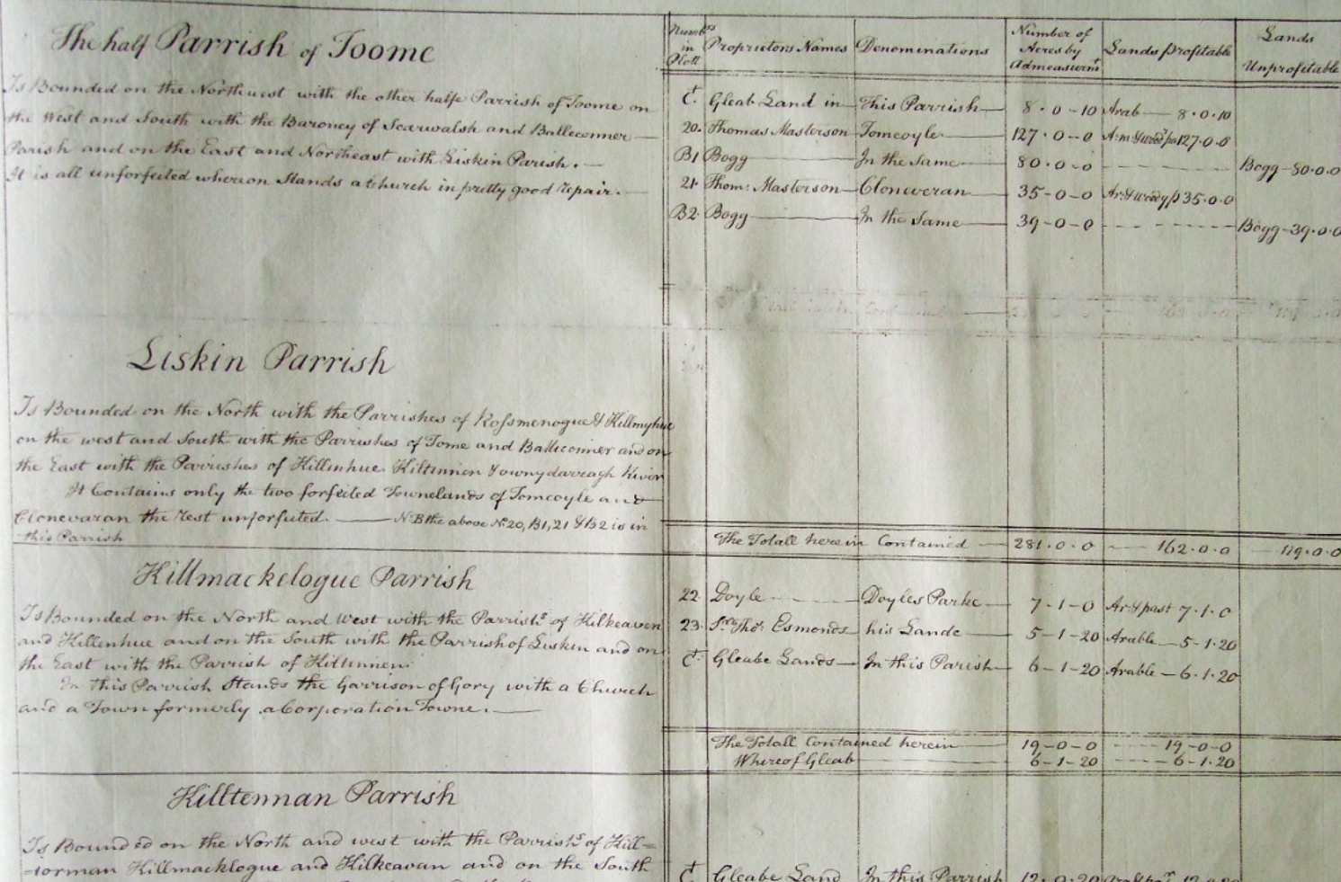
Page 3 – Barony of Gorey – Parishes of Liskin, Kilmclogue, Kiltinen and Toome
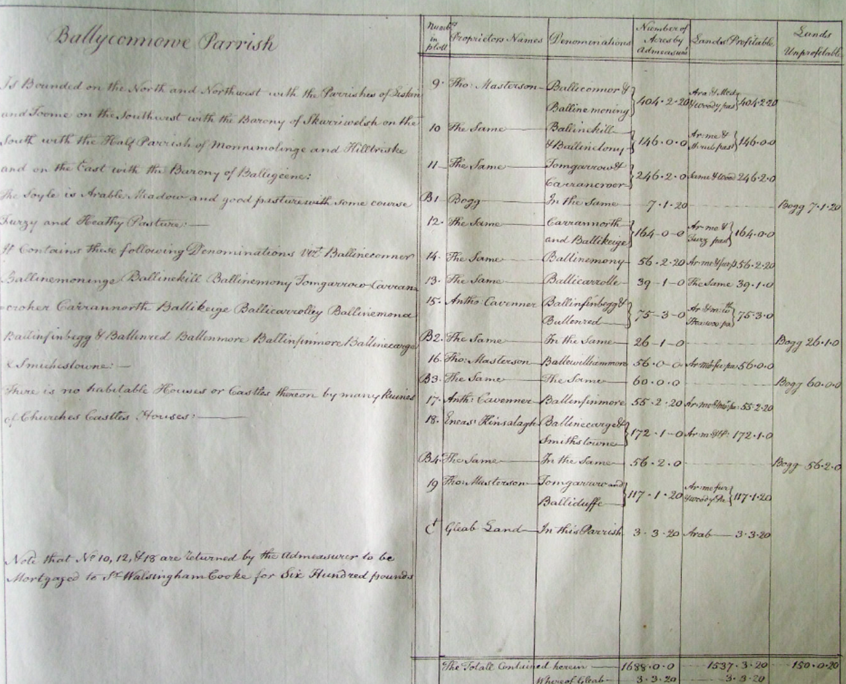
Page 4 – Barony of Gorey, Parish of Ballycannowe
See if you spot many of the modern towlands with their earlier historic names.
Have fun locating Balloughter townland on the maps (it is not shown) and remember when searching that the maps may be very accurate for their time but not by today’s standards. You should pay particular attention to the compass direction to get your bearing before you ‘guess’ the location.
Permission courtesy of the National Library of Ireland.
Selecting the 1670 map (or other) and zooming in on maximum to the south west edge the Toome Parish, Gorey Barony.
The townland boundaries appear automatically on maximum zoom and you can click on the townland to view the landowners.
Don’t forget to read the Terrier (information document) associated with each Down Survey townland map.
Full details of this survey including County/Barony/Parish maps covering the whole of Ireland are available on a dedicated section of theTrinity College website.