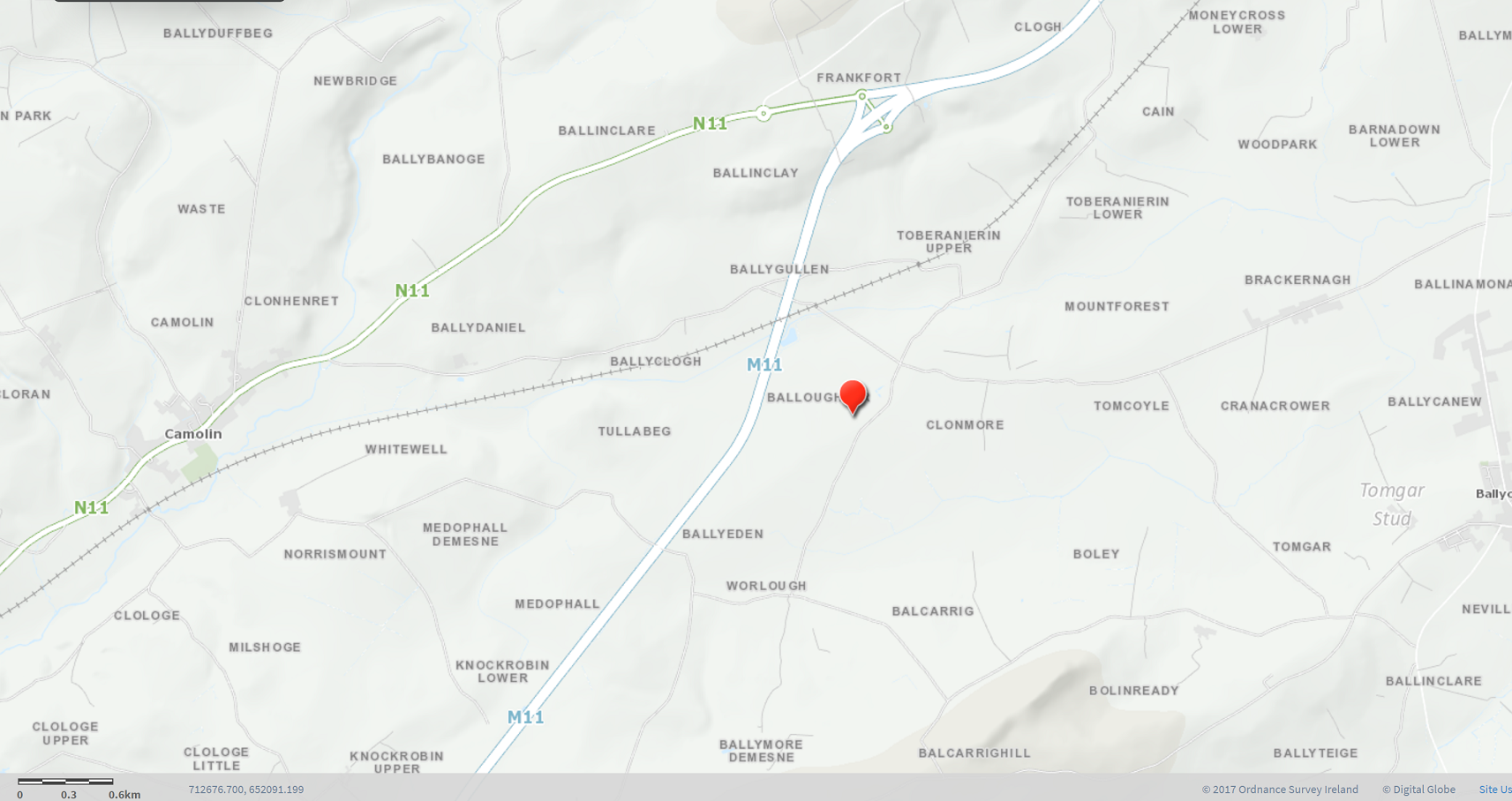
Maps of Ballyoughter
In this section, you will have the opportunity to view, explore and learn about Ballyoughter townland and its surrounding area on a series of modern maps.
You can also delve into the Historical Maps section on the site to learn more about the area and its past.
Neighbouring Townlands of Ballyoughter
View Ballyoughter on Google Maps
Ballyoughter on 'Townlands.ie'
Check out more about Ballyoughter using these maps by clicking on the links below:
Map, Area Information and List of Townlands in the Balloughter Electoral Division
This site provides a map of the Balloughter Electoral Division and allows you to ‘zoom in/out’ on a map of each of its 25 townlands.
It provides the information on each townland:
- Origins of the townland name
- Map of the townland
- Area statistics
- Bordering townlands
- Links to ‘OpenStreetMaps’ and Geneaology and Ancestry sites.
Ballyoughter on 'OpenStreetMaps'
Map of Balloughter Electoral Division on ‘OpenStreetMaps’
Among this app’s many features, you may use the ‘Query’ Arrowhead icon feature to find out more about an area, building, map feature, etc.
The link to the ‘OpenStreetMaps’ site is provided courtesy of “© OpenStreetMap contributors” – documentation is licensed under the Creative Commons Attribution-ShareAlike 2.0 license (CC BY-SA 2.0).
Historical Maps of Ballyoughter on 'OSI'
Check out a range of historical maps on the area using the ‘National Townland and Historic Environment Viewer’ site.
Information and details on how to use the site are outlined in Ballyoughter/The Past/Historical Maps.
The maps available are:
- Historic Map 25 inch (1888-1913)
- Historic Map 6 inch (1837-1842) B/W and Colour
- 6 inch Cassini (1830s to 1930s)
- Wide variety of maps based on Population and Economy, Nature and Environment, Aerial (various years 1995-2018)